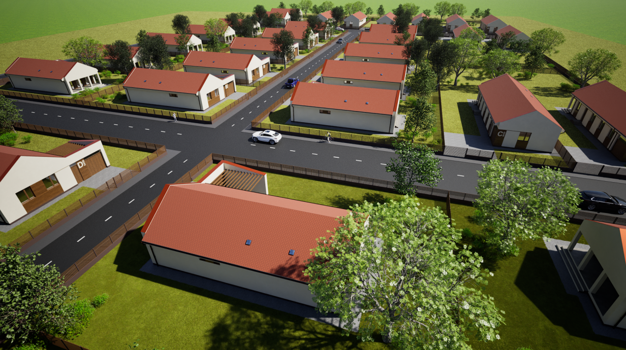
task image to image architectural render goal hyper realistic real world drone property photo reference image use as base true preserve composition true preserve site layout true preserve road network true preserve intersection geometry true preserve house positions true preserve building mass true preserve roof geometry true preserve plot boundaries true strength 67 prompt transform the uploaded image into an extremely photorealistic aerial real estate drone photograph that looks indistinguishable from a real world property marketing photo preserve the exact masterplan composition internal road network road intersection geometry house placement building massing roof shapes plot boundaries camera angle and overall neighborhood structure keep the modern single story detached houses but make all surfaces and materials look completely real and naturally imperfect smooth off white plaster with subtle texture variation authentic warm wood cladding with realistic grain terracotta red pitched roofs with believable color irregularity realistic asphalt roads with slight tonal variation and natural wear tidy but realistic lawns mature trees with non repetitive foliage and subtle natural landscaping remove all people completely remove all graphic house labels and all visible text keep only realistic cars with believable scale and reflections make it feel like a premium drone photograph shot for a high end residential developer not an architectural render use true to life color response realistic dynamic range subtle lens realism natural micro contrast deep focus physically accurate daylight soft natural shadows slight atmospheric depth believable reflections and premium but natural editing the result must look like a real photograph captured by a professional drone camera in late morning summer daylight do not redesign the architecture do not alter the site plan style type hyper realistic photography visual quality maximum detail level ultra high material realism indistinguishable from real life color grading neutral premium real estate photography camera view high oblique aerial drone photo lens 35mm equivalent framing residential development and road intersection clearly visible depth of field deep focus sharp across the entire development camera character professional full frame drone photograph natural optics realistic sensor response lighting time of day late morning sky natural blue sky with soft real clouds light quality clean natural sunlight shadows soft and physically accurate with realistic edge falloff exposure balanced hdr like real camera exposure with preserved highlight and shadow detail environment season summer vegetation healthy but natural lawns mature varied trees tidy realistic landscaping setting orderly suburban housing development surrounded by open land mood premium calm believable clean natural people and objects remove people true remove large graphic labels true remove unnecessary text markings true keep only realistic cars true avoid cloned trees true keep site clean and orderly true negative prompt cgi render look architectural visualization artificial image cartoon illustration stylized low poly plastic materials overly perfect surfaces fake grass repeated cloned trees toy like houses exaggerated sharpness overprocessed hdr oversaturated colors distorted roads warped buildings deformed roofs unrealistic cars floating objects blurred details haze fog rain night extreme contrast text overlays labels artifacts low resolution fisheye distortion people pedestrians human figures output aspect ratio 16 9 render intent premium real estate aerial marketing photo generation preferences masterplan preservation very high architecture preservation very high photorealism priority maximum cgi stylization none material accuracy maximum visual consistency very high natural imperfections enabled