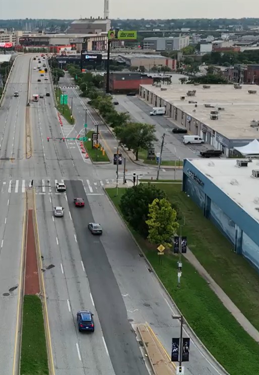
analyze the attached drone image of russell st hamburg st in baltimore viewed from mlk jr blvd focus only on the right side of russell st after the intersection where the mlk off ramp merges into russell st and the bike lane service road create a conflict zone develop 3 4 design iterations addressing merge geometry smoother taper merge angle and sightlines bike lane continuous protected and predictable through the merge service road clearer entry consolidation or reconfiguration signage markings clearer striping wayfinding and priority also create one iteration that only reshapes re curves the bike lane and service road to eliminate awkward angles and crossing conflicts do not alter the main travel lanes or off ramp geometry base every iteration directly on the attached image and show clear before after geometry