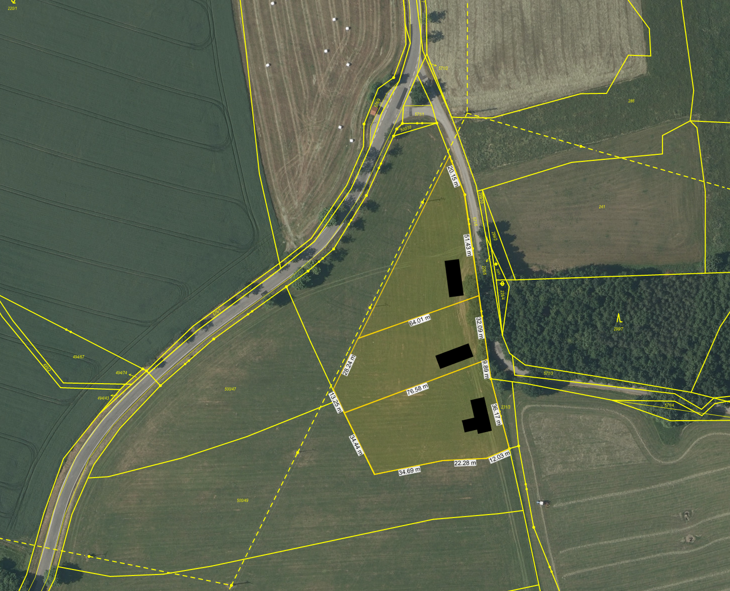
edit the supplied aerial map into an architectural site plan visualization replace the three black building footprints with realistic roof views of three rural family houses the black shapes define the exact building footprints preserve their position orientation dimensions and outline the upper and middle houses are rectangular the lower house is l shaped do not move enlarge or redesign them do not apply the same dimensions to all three houses use simple pitched roofs with muted dark grey roofing add a private garden a modest terrace and two parking spaces for each house connect each house with a short driveway to the existing road immediately to the right of the plots keep all additions within their respective plot boundaries preserve the original aerial view map scale plot boundaries existing roads surrounding fields and woodland treat yellow lines and dimension labels as map annotations not physical objects maintain a strict vertical top down view with natural materials restrained landscaping and soft subtle shadows no perspective tilt additional houses or new roads the priority is to visualize the supplied layout faithfully