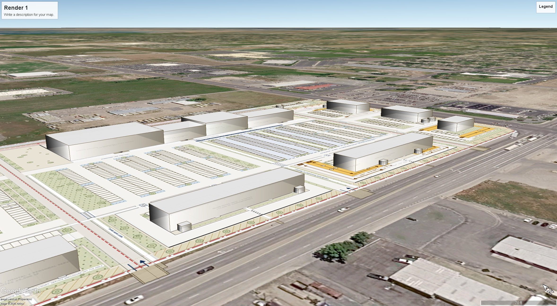
use the uploaded google earth kmz image as the absolute authority for camera position perspective building footprints building locations massing parking geometry drive aisles access points sidewalks landscape areas roads property boundaries and all surrounding existing conditions this is an architectural visualization of the development already shown in the source image not an opportunity to redesign the site plan do not add remove relocate enlarge shrink rotate or invent buildings parking fields roads sidewalks parks plazas green spaces or other site elements that are not shown in the source critical preserve every drive thru exactly as drawn including the complete wraparound lane alignment stacking length bypass lane where shown order point area building side pickup lane curb geometry ingress egress and relationship to adjacent parking and internal drives never replace drive thru pavement with landscaping parking patios sidewalks or ordinary circulation create a high quality institutional suburban retail development appropriate for a strong mountain west market with individual architectural identity for the grocery anchor junior anchors inline retail restaurants and outparcel buildings while maintaining a coordinated overall design language use strong fa ade articulation with projecting and recessed tenant bays varied parapet heights differentiated corner elements defined signage zones deep canopies architectural entry frames selective masonry piers and substantial storefront openings so buildings never read as repetitive flat boxes use moderate glazing rather than excessive curtain wall concentrating larger glass areas at primary entrances corners restaurants and important tenant storefronts while retaining enough solid wall and masonry to give the buildings permanence and substance give restaurant and prominent outparcel buildings strong four sided architecture outdoor dining where the source plan accommodates it and richer landscape treatment but do not expand patios walks or landscape beyond the areas shown in the source plan use mature but realistic mountain west landscaping with deciduous shade trees ornamental grasses native drought tolerant shrubs selective decorative boulders and landscaped islands keeping storefront visibility and circulation clear render as a high end professional commercial real estate drone photograph with realistic construction detailing rooftop equipment pavement striping vehicles signage scale shadows material texture and restrained human activity the finished result should look buildable by a major institutional retail developer rather than like a conceptual fantasy rendering architectural style c dark accent contemporary mountain west create a sharper more contemporary interpretation using warm neutral masonry as the base with stronger charcoal black architectural framing dark metal parapets and canopies black storefront systems selective textured stone restrained medium tone wood accents and limited warm brick use dark architectural elements to frame entrances storefront bays rooflines corners signage and projecting volumes rather than creating monolithic black or gray buildings emphasize crisp horizontal proportions stronger contrast deeper fa ade recesses and projections pronounced corner glazing and modern entry portals but retain sufficient masonry and texture so the center feels permanent and inviting rather than industrial or warehouse like avoid blank tilt up walls large exposed concrete surfaces repetitive rectangular boxes oversized black masses and the generic modern industrial aesthetic the anchor should have more architectural hierarchy and fa ade movement than a conventional big box with taller glazed entrances and layered framing while inline and outparcel buildings should receive stronger individual tenant expression use cleaner slightly cooler late afternoon light with restrained warmth strong but natural shadow definition subtle warm interior illumination and crisp dark metal contrast so the result feels newer and more design forward than the other two versions without becoming trendy background this camera looks toward north logan and the eastern side of cache valley so use the supplied street level and aerial background references as the factual guide beyond the project retain the real mixture of existing commercial light industrial properties roads open parcels agricultural fields school sports field areas and low density north logan residential development gradually transitioning into the developed valley floor rather than inventing a dense city the bear river range mountains east of logan should form the major natural backdrop appearing relatively close tall rugged and continuous as shown in the reference photographs with dry tan late summer early fall foothills and natural darker vegetation in the higher terrain match the actual mountain scale silhouette placement and valley relationship from the supplied references rather than creating a generic mountain range do not replace the real valley with endless houses or add fictional subdivisions towers shopping centers or other development