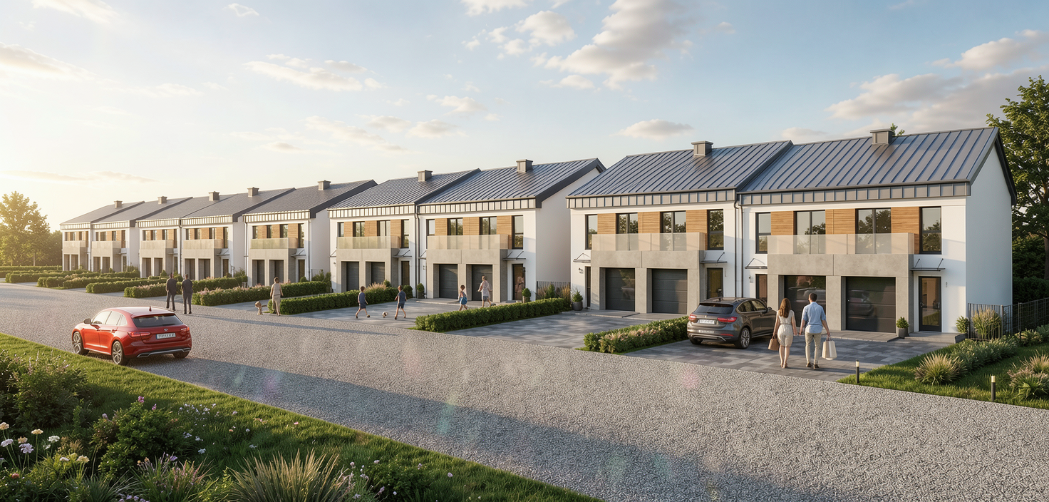
use the provided architectural visualization as the reference image before generating the new view carefully analyze the entire scene including the architecture site layout terrain road network landscaping building spacing and overall composition your task is to create a new aerial bird s eye view of the development while preserving the architectural design exactly as shown in the reference primary objective generate a photorealistic bird s eye view that showcases the entire development from above providing a clear understanding of the site layout while maintaining complete architectural accuracy preserve the architecture do not modify building geometry fa ades roof design and roof slopes windows doors garage doors materials colors proportions building heights spacing between buildings orientation or any architectural details the buildings must remain an exact representation of the reference visualization preserve the site layout do not change the masterplan road layout driveways sidewalks parking areas retaining walls landscaping terrain property boundaries or any spatial relationships every element must remain in its original location terrain accuracy critical carefully analyze the terrain before generating the aerial view if the development is located on sloping ground preserve all elevation differences stepped building positions retaining walls driveway slopes roof height relationships and the natural terrain profile do not flatten or simplify the terrain camera position create a professional architectural drone style viewpoint elevated approximately 15 30 meters above the development viewed from a front three quarter aerial angle showing the entire development in one frame maintaining realistic perspective avoiding extreme wide angle distortion keeping vertical proportions natural the aerial view should clearly present the relationship between the buildings roads driveways and surrounding landscape rendering quality produce an ultra high quality photorealistic render featuring physically accurate lighting realistic shadows premium pbr materials high resolution textures realistic vegetation detailed roads and pavements natural sky global illumination ambient occlusion realistic reflections crisp image quality suitable for print and digital marketing visual consistency match the style lighting atmosphere and color grading of the reference visualization so the aerial render becomes part of the same visualization series for brochures websites investor presentations and marketing materials final goal create a premium architectural bird s eye render that looks as though it was produced by the same visualization studio as the original image the only change should be the camera position the architecture masterplan terrain and every design element must remain 100 identical to the reference visualization