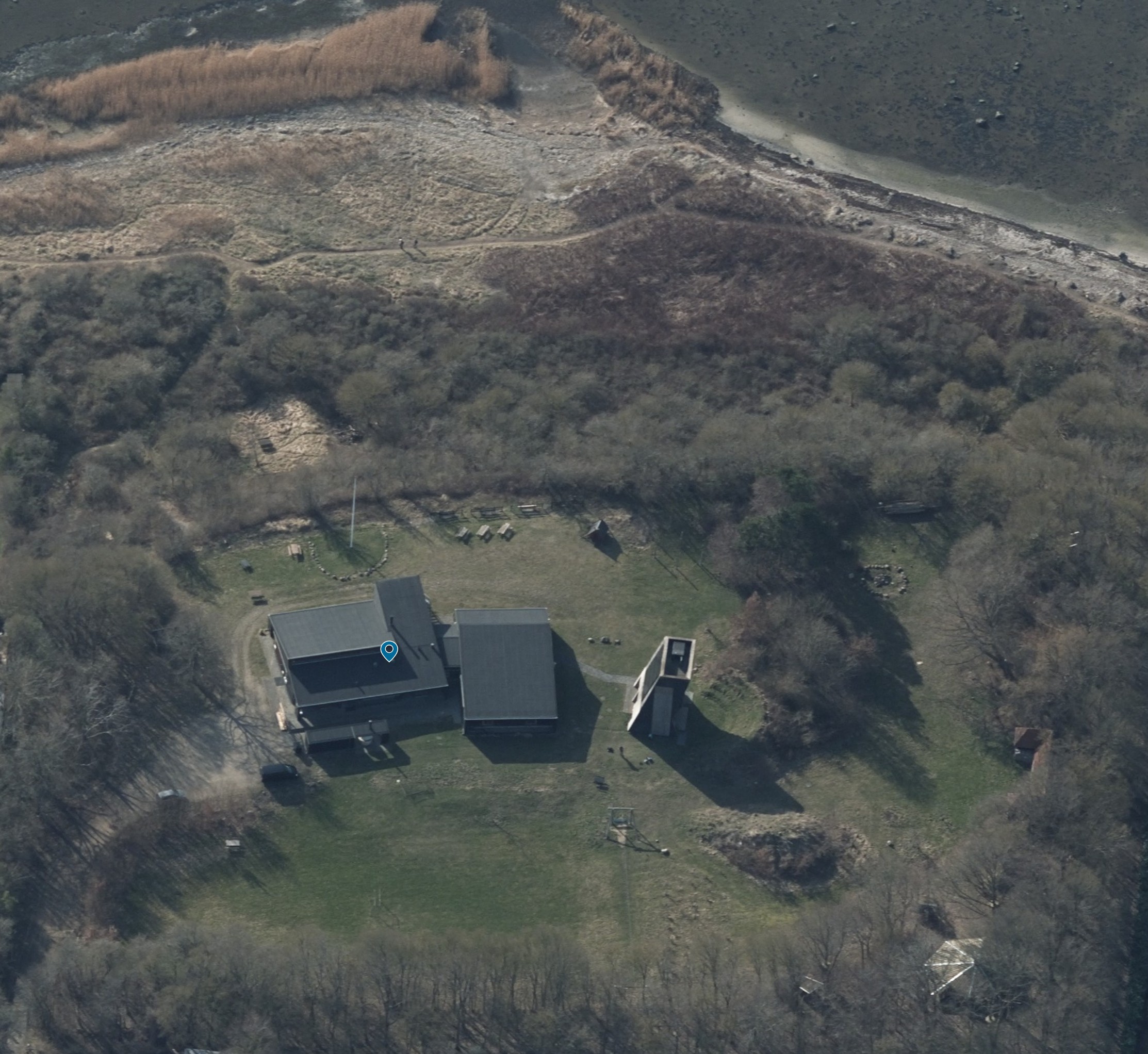
transform the uploaded aerial oblique photograph into a clear attractive illustrated visitor map the image should become a hand drawn graphic site map similar to maps used in amusement parks nature centers scout camps outdoor activity parks and recreational destinations maintain the overall layout and orientation of the site important site elements roskilde fjord is located at the top of the image a path leads from the camp area down to the beach and shoreline the large main lodge consists of two connected buildings kitchen and dining hall on the left side sleeping quarters on the right side the tall building immediately to the right of the lodge is a climbing wall arrival road and parking area are located to the left of the lodge a shelter is located in the lower right corner of the site a large open grass field occupies the central area the grass field contains a football field and a zipline a flagpole is located near the main activity area a campfire area is an important gathering point style requirements illustrated park map family friendly graphic design easy to understand at a glance slightly playful but architecturally coherent clear hierarchy and navigation hand drawn appearance watercolor and ink illustration attractive landscape graphics soft colors nordic outdoor recreation atmosphere presentation quality visitor map map requirements include labels for all major destinations use clear paths and circulation routes emphasize important activity areas show vegetation lawns shoreline and buildings clearly use simplified illustrated icons where appropriate maintain realistic relationships between locations prioritize readability over realism the final result should feel like a professionally designed visitor map for a scout camp outdoor education center or nature park