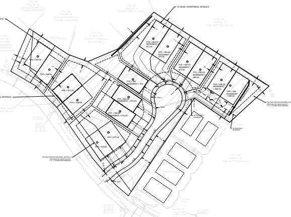
transform this architectural site plan into a premium aerial presentation rendering while preserving the exact property lines roads lot layout house footprints dimensions labels easements and engineering information make it appear as if viewed from a high altitude drone directly overhead replace flat cad graphics with lush photorealistic landscaping including manicured lawns mature trees shrubs flower beds realistic asphalt streets concrete sidewalks driveways and detailed residential roofs add realistic shadows from trees and buildings subtle terrain variation rich green grass with mowing stripes natural landscaping and high end neighborhood aesthetics keep all survey text parcel boundaries dimensions contour information utility notes and callouts crisp readable and perfectly aligned use realistic lighting from late afternoon with soft shadows vibrant but professional colors ultra high resolution clean presentation suitable for luxury residential development marketing civil engineering exhibits or planning commission presentations do not alter the geometry scale orientation or any technical information only enhance the visual appearance