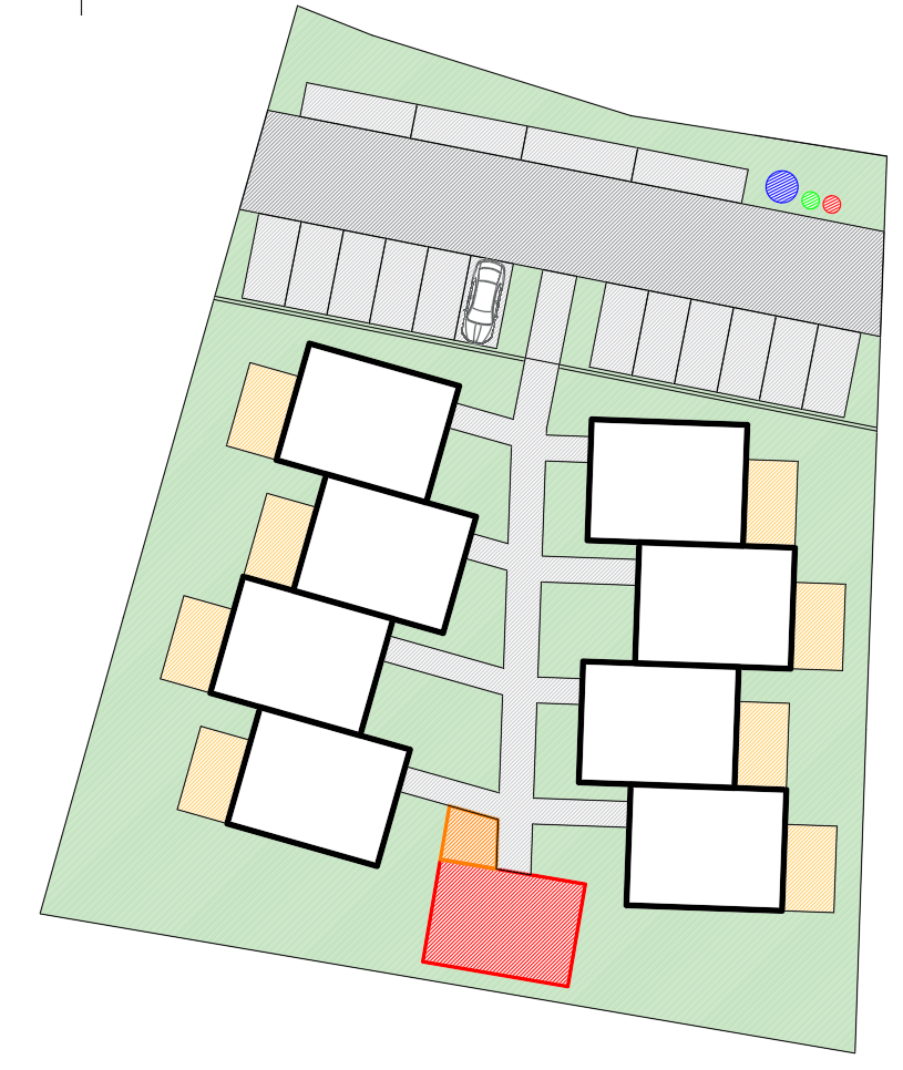
transform the provided 2d autocad site plan into a highly photorealistic aerial architectural visualization of a contemporary residential development critical strictly preserve the original site plan geometry maintain the exact positions footprints orientations proportions and number of buildings preserve all roads driveways plot boundaries and spatial relationships exactly as shown in the reference drawing do not redesign or reinterpret the masterplan convert the 2d building footprints into realistic contemporary single family houses with pitched roofs minimalist architectural forms light plaster facades natural timber accents and dark grey metal roofing create a realistic residential environment with asphalt access roads paved driveways pedestrian paths green lawns private gardens subtle landscaping scattered trees and natural vegetation surround the development with realistic lithuanian suburban landscape camera high angle oblique aerial drone view approximately 45 degrees downward capturing the entire development in one composition maintain accurate architectural proportions and realistic perspective visual style premium european architectural competition visualization photorealistic materials natural summer daylight soft shadows realistic vegetation subtle atmospheric depth professional architectural rendering 8k quality avoid additional buildings modified building positions altered road layouts distorted geometry exaggerated landscaping fantasy architecture excessive trees obscuring the buildings text labels and diagrammatic elements