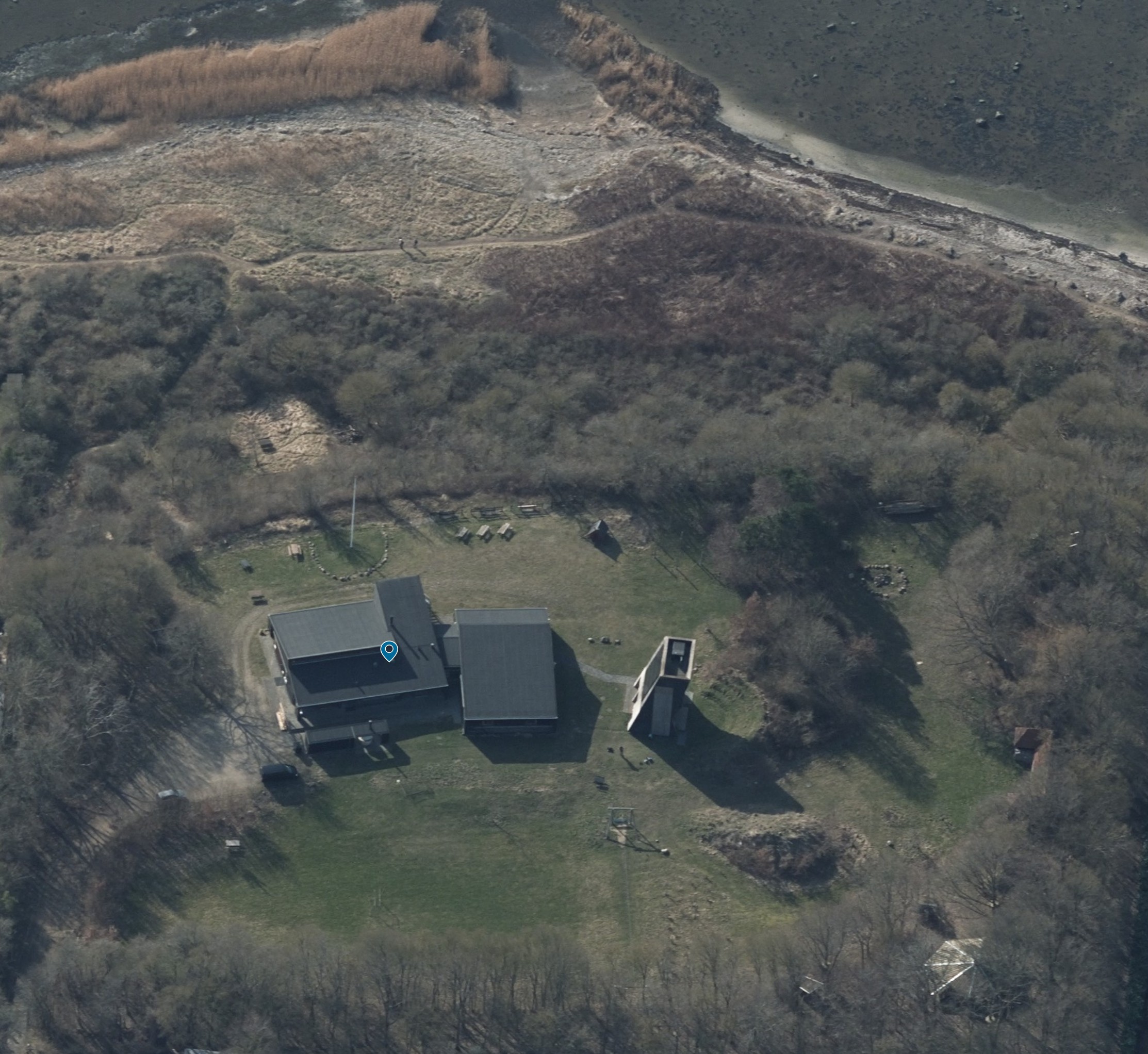
this is an illustration and tracing task not a design task use the uploaded aerial photograph as the single source of truth transform the photograph into a clean attractive illustrated visitor map while preserving the actual site exactly as it exists do not redesign improve optimize reinterpret or add features only illustrate features that are visible in the photograph maintain the real positions sizes proportions terrain and spatial relationships shown in the image site structure roskilde fjord is located at the top of the image a path leads from the camp area to the shoreline the main lodge consists of two connected buildings the left part contains the kitchen and dining hall the right part contains the sleeping quarters a climbing tower is located immediately to the right of the lodge the arrival road and parking area are located to the left of the lodge a shelter is located in the lower right part of the site a large open grass field occupies the central area the zipline is located on the grass field directly below the climbing tower a flagpole and campfire area are located within the main activity area there is only one path from the site to the path by the water it is in the left side of the picture terrain requirements between the climbing tower and the shelter there is a hill the hill is open landscape terrain the hill must remain undeveloped do not place any building cabin shelter pavilion tower platform activity structure or other construction on the hill building requirements the lodge must have its existing roof form as seen in the photograph do not add roof terraces do not add rooftop decks do not add rooftop viewing platforms do not add rooftop activity areas rooftop structures should not be altered graphic requirements remove all text from the final image remove all labels and annotations no captions no legends no callouts no signage style illustrated visitor map scandinavian outdoor recreation style hand drawn landscape illustration watercolor and ink rendering clean and easy to understand soft natural colors professional map graphics attractive but realisticcritical instruction when uncertain copy the photograph do not invent content do not add buildings do not add lakes ponds roads paths attractions structures or landscape features that are not visible in the photograph empty areas must remain empty the final image should be a faithful illustrated map of the existing site not a redesigned version of it