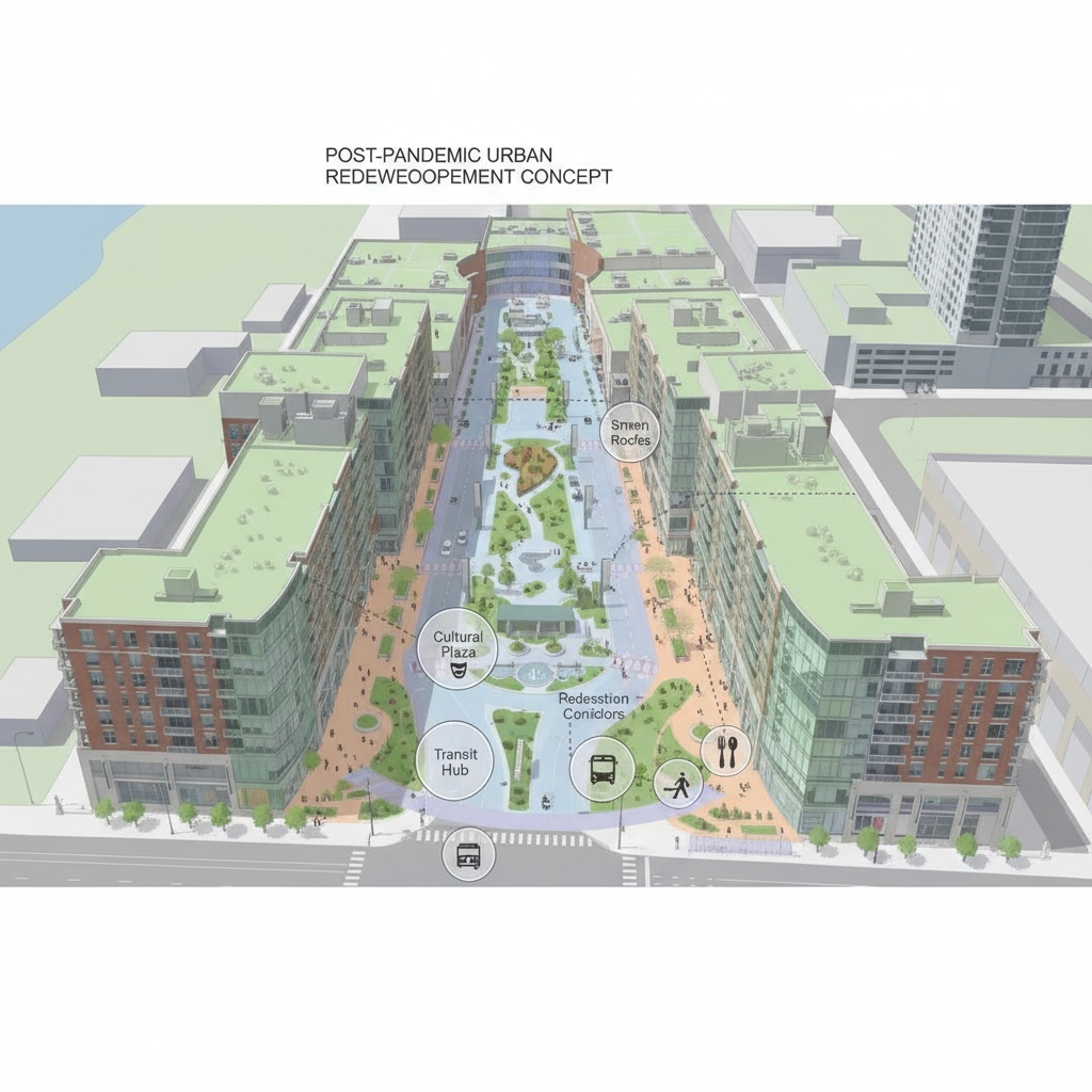
looking like sketch up or arc gis create an isometric urban design diagram based on an aerial photo of a city block show a proposed post pandemic urban redevelopment concept include labeled layers for new mixed use buildings public plazas parks and pedestrian corridors use a clean architectural axonometric style with pastel tones vector like clarity and soft shadows overlay transparent colored zones and circular callout bubbles connected by dotted lines labeling design features such as green roofs transit hub cultural plaza restaurant ring and smart density integrate icons for food transportation and green spaces maintain the look of a professional architectural presentation board similar to perkins eastman s madison square gardens urban concept combining real context with stylized diagrammatic overlays