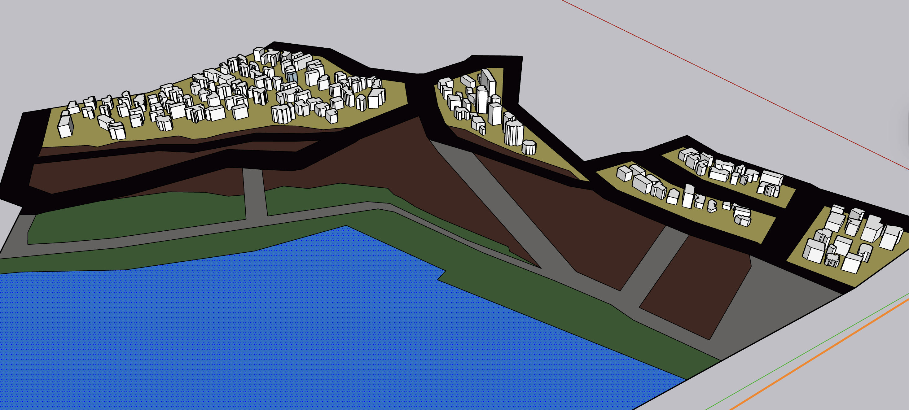
the yellow areas indicate residential zones the green areas represent the coastal restoration zone formed in response to shoreline processes the brown areas mark the government acquired demolition zone which functions as a walkable corridor during low tide an d need to show retreat process the blue areas denote the ocean the area located behind the residential zone remains designated for residential use the left hand beach has a steeper gradient behind this area the background is residential area not sea the grey are is decommissioned coastal road ghost line government acquired zone boundary and retreat setback distance 35m inland need architecture