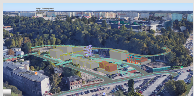
ultra realistic architectural visualization based on an existing google maps aerial photo preserve the original terrain shape existing roads greenery trees surroundings urban layout and all environmental context exactly as they are do not modify the topography infrastructure neighboring buildings or street network the gray rectangular blocks are proposed service commercial buildings transform them into realistic contemporary architecture with a light industrial style facade use elegant industrial materials such as corten steel accents dark metal panels glass exposed concrete perforated metal and warm architectural lighting the buildings should feel modern refined realistic and naturally integrated into the environment only the elevated pathway suspended on columns in the air should be deep burgundy dark wine red the central spiral structure must also remain burgundy and visually connected to the elevated pathway design language do not change the color of any roads on the ground ground streets asphalt roads parking areas and existing infrastructure must stay exactly as in the original google maps image keep all greenery and roads unchanged maintain the exact composition and proportions from the source image the goal is photorealism and believable urban integration as if the project was already built and photographed professionally from above add realistic shadows reflections textures people subtle cars atmospheric lighting and natural depth while preserving the original google maps perspective