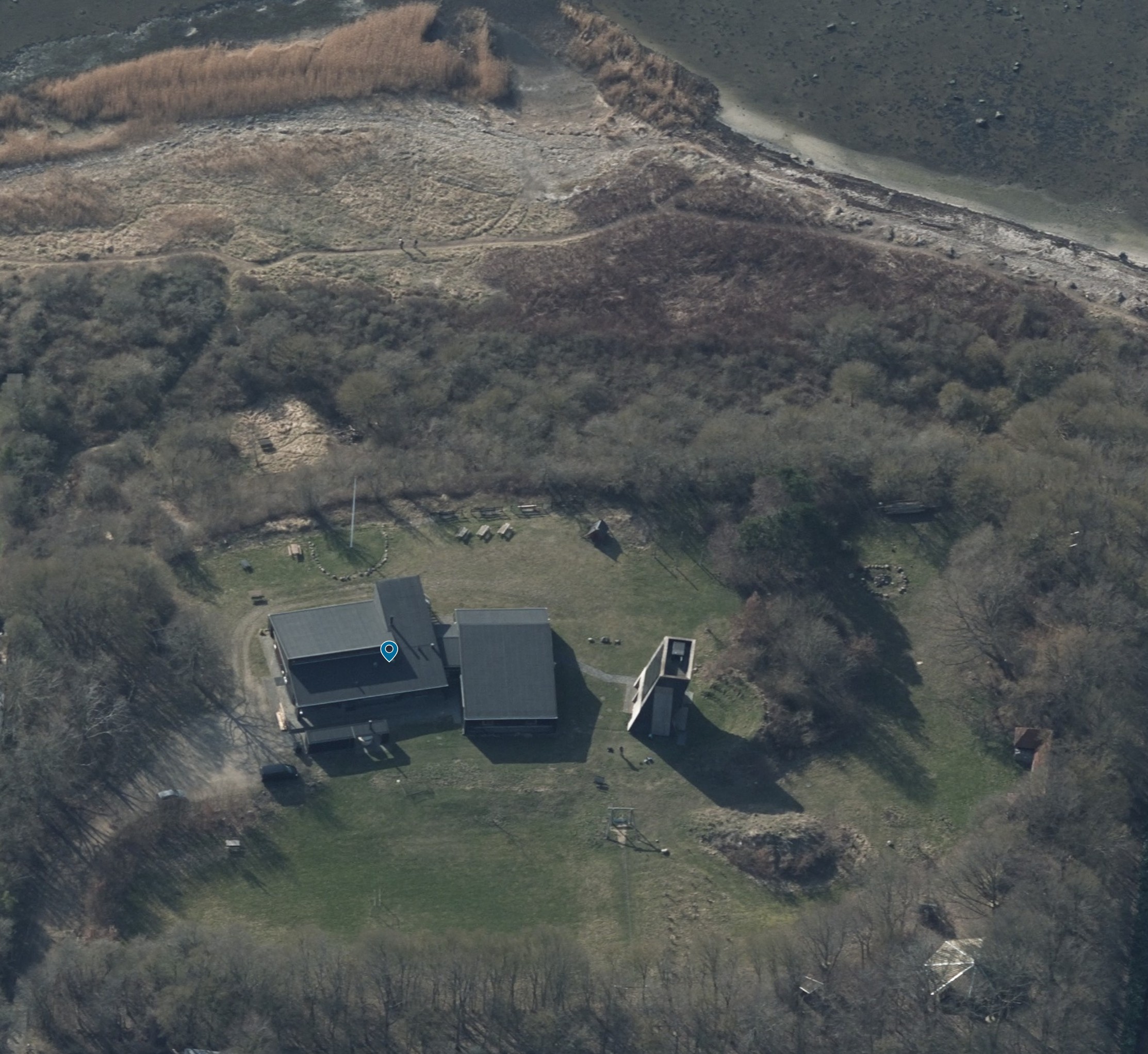
this is an illustration task not a design task use the uploaded aerial photograph as the only source of information do not invent add redesign improve optimize or create any new elements only depict features that are clearly visible in the photograph or explicitly described below the purpose is to transform the photograph into a clear and attractive illustrated visitor map while preserving the actual site maintain the exact spatial relationships positions sizes and orientations visible in the photograph do not add new buildings new roads new paths new lakes or ponds new activity areas new vegetation zones new structures new landmarks only illustrate existing features visible in the image known features visible in the photograph roskilde fjord at the top of the image path leading from the camp area to the shoreline large two part lodge building kitchen and dining hall in the left wing sleeping quarters in the right wing climbing wall building immediately east of the lodge arrival road and parking area west of the lodge shelter in the lower right part of the site large open grass field football field zipline flagpole campfire area all other elements must be derived directly from the photograph map style illustrated visitor map scandinavian outdoor recreation style hand drawn landscape graphics watercolor and ink rendering clear labels simple graphic hierarchy easy navigation family friendly presentation important the goal is not to redesign the site the goal is to accurately trace and illustrate the existing site shown in the photograph think of the task as converting an aerial photograph into a professionally illustrated visitor map preserve reality do not invent content do not add attractions do not fill empty spaces with new features