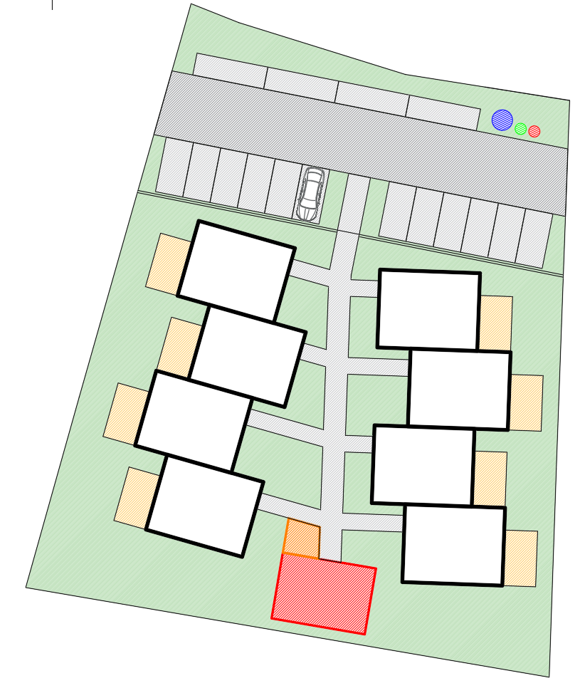
transform the provided 2d autocad site plan into a highly photorealistic aerial architectural visualization of a contemporary residential development critical strictly preserve the original site plan geometry maintain the exact positions footprints orientations proportions and number of buildings preserve all roads driveways plot boundaries and spatial relationships exactly as shown in the reference drawing do not redesign or reinterpret the masterplan convert the 2d building footprints into realistic contemporary single family houses with pitched roofs minimalist architectural forms light plaster facades natural timber accents and dark grey metal roofing create a realistic residential environment with asphalt access roads paved driveways pedestrian paths green lawns private gardens subtle landscaping scattered trees and natural vegetation surround the development with realistic lithuanian suburban landscape camera high angle oblique aerial drone view approximately 45 degrees downward capturing the entire development in one composition maintain accurate architectural proportions and realistic perspective visual style premium european architectural competition visualization photorealistic materials natural summer daylight soft shadows realistic vegetation subtle atmospheric depth professional architectural rendering 8k quality create a highly photorealistic aerial architectural visualization based strictly on the provided autocad site plan the provided drawing is the absolute primary reference and must be followed precisely this is a visualization task not a design task do not redesign reinterpret rearrange or modify any elements shown in the original drawing maintain the exact number location orientation footprint shape and proportions of all buildings strictly preserve the geometry of roads driveways pathways plot boundaries and all other elements shown in the drawing every building must correspond directly to its footprint in the provided plan do not invent relocate rotate resize or add buildings do not change the site layout under any circumstances use the drawing as a fixed geometric blueprint only enhance it by adding realistic architectural materials roof surfaces natural vegetation lawns paving textures lighting and environmental details without changing the underlying geometry generate a realistic contemporary lithuanian residential neighborhood with minimalist single family houses natural facade materials realistic landscaping and surrounding greenery camera professional aerial drone photography elevated bird s eye perspective approximately 45 degrees downward showing the entire site development style ultra photorealistic architectural visualization natural daylight realistic shadows detailed materials professional architectural competition rendering most important geometric accuracy and strict compliance with the provided autocad drawing take absolute priority over visual creativity no additional buildings no altered footprints no changes to road geometry no invented architectural elements no modifications to the original masterplan